Sylvia
Lesotho’s Geographic Profile and Climate
GEOGRAPHIC PROFILE
Located near the southernmost edge of the African continent at coordinates 29° South and 28° East, the Kingdom of Lesotho is one of the few countries in the world classified as an enclave state. Entirely surrounded by South Africa, it shares this rare geographical distinction only with San Marino and Vatican City, both of which are enclosed within Italy.
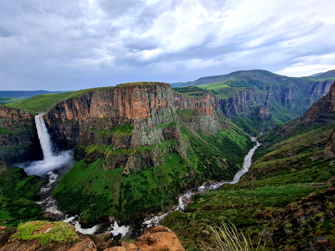
Mountains dominate nearly two-thirds of Lesotho’s landscape, shaping both its physical identity and cultural imagery. This dramatic terrain has earned the country enduring descriptions such as the “Kingdom in the Sky” and the “Switzerland of Africa.” The nation’s topography is broadly divided into four main geographical regions, each defined by elevation and location.
The lowlands are situated in the south-western parts of the country, primarily along the Caledon River, at elevations ranging from 1,400 to 1,800 metres above sea level. Moving inland, the foothills form a transitional zone between the lowlands and the highlands, rising to between 1,800 and 2,200 metres and stretching mainly across central and eastern Lesotho.
The Senqu River Valley extends from Mohale’s Hoek and Quthing in the south through to Mokhotlong in the north-east. Elevations in this corridor generally range between 1,400 and 1,800 metres above sea level. The eastern and south-eastern regions of the country are dominated by the highlands, which form part of the Drakensberg escarpment. Altitudes in this area range from 1,400 metres to the summit of Thabana-Ntlenyana at 3,482 metres.
The highlands contain extensive wetlands that serve as the source of many of Southern Africa’s major rivers. Among them is the Senqu, also known as the Orange River, which stretches approximately 2,200 kilometres. One of the longest rivers on the African continent, the Senqu forms several international boundaries before eventually flowing into the Atlantic Ocean in Namibia.
Lesotho’s lowest elevation is found at the confluence of the Senqu and Makhaleng rivers, at 1,400 metres above sea level. This unique characteristic means Lesotho is the only country in the world whose entire landmass lies above 1,000 metres, reinforcing its reputation as a nation elevated closer to the sky.
CLIMATE
Lesotho’s climate is largely shaped by its altitude, resulting in generally cool conditions throughout the year. Rainfall occurs mainly during the summer months, while winters are typically cold and dry. In the lowlands, summer temperatures often reach around 30°C, while winter temperatures may fall to approximately −7°C. Conditions in the highlands are more extreme, with summer temperatures ranging from the mid-20s to early-30s degrees Celsius and winter temperatures occasionally dropping as low as −20°C, accompanied by snowfall.
Annual rainfall varies across the country, averaging about 600 millimetres in the lowland valleys and increasing to roughly 1,200 millimetres in the northern and eastern escarpment areas. Most rainfall occurs between October and April, while the winter months from May to September are largely dry. Snowfall is common during winter, particularly in the highlands, and higher mountain peaks may experience snow at any time of the year.
Rainfall patterns are irregular, with significant variation from year to year. As a result, Lesotho periodically experiences droughts during dry seasons and flooding during periods of heavy rainfall. Owing to these climatic characteristics, Lesotho is widely regarded as the coldest country in Africa.